解説英文のテキスト
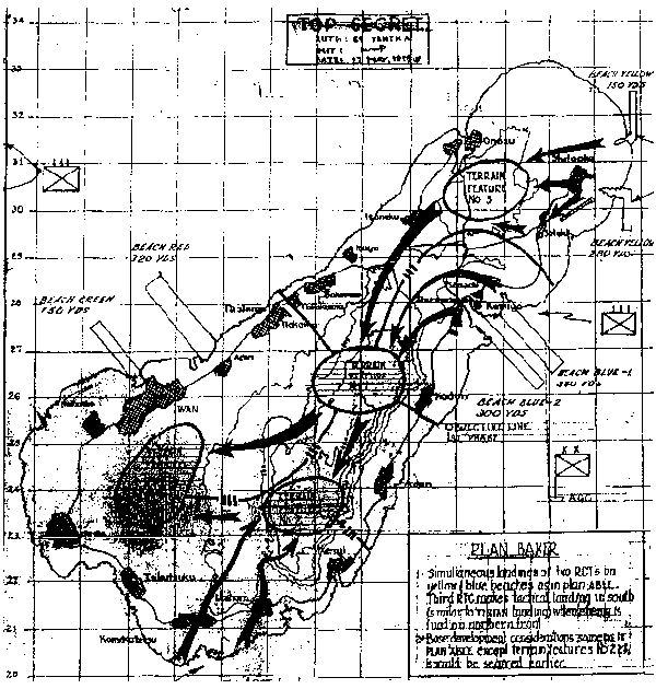
PLAN BAKER
1. Simultaneous landings two RCTs on
yellow & blue beaches as in ABLE.
Third RCT makes tactical landing in south
(similar to TINIAN landings) where enemy is
fixed on northern front.
2. Base development considerations same as in
PLAN ABLE except terrain features No2 & 4
should be secured earlier.